


DHAKA BUREAU: The deep depression over the Southeast Bay of Bengal has intensified and turned into a cyclonic ‘Mokha’. This information was given in a special notification issued by the Bangladesh Meteorological Department on Thursday (May 11) morning. The cyclone may turn back and move towards the north-northeast after gradually gathering strength. It is feared that it may develop into a supercyclone of monstrous strength.
According to the notification, the deep depression over the Southeast Bay of Bengal and adjoining areas has condensed and turned into a cyclone named “Mokha’ in the same area. It can be more concentrated. Chittagong, Cox’s Bazar, Mongla, and Payra sea ports have been asked to display two (two) remote warning signals. Besides, all fishing boats and trawlers operating in the North Bay of Bengal and deep sea have been asked to move cautiously from near the coast. Also, they are told not to wander in the deep sea.
It is further informed that today at 6 a.m., we are 1295 km from Chittagong sea port. In the south-southwest, the cyclone was located 1220 km south-southwest of Cox’s Bazar seaport, 1265 km south-southwest of Mongla seaport, and 1225 km south-southwest of Payra seaport. It may become more concentrated until Friday (May 12) morning and then change direction and gradually move north-northeast.
According to the Meteorological Department, the maximum sustained wind speed within 54 km of the cyclone center is 62 km per hour. Which is increasing up to 88 km in the form of gustsmum sustained wind speed within 54 km of the cyclone center is 62 km per hour. which is increasing up to 88 km in the form of gusts. The sea is rough in the vicinity of the cyclone center.
Mostafa Kamal Palash, a weather and climate researcher at the University of Saskatchewan, Canada, said that according to the main weather forecast model, the tip of cyclone Mokha is expected to hit the coast of Chittagong Division between 6 a.m. and 12 p.m. on May 14. The center of the cyclone is expected to cross the coast from noon to evening, and the rear part from evening to Monday morning. Models indicate the highest probability of landfall over Chittagong, Cox’s Bazar, and Myanmar’s Rakhine state. At the time of landfall, wind speeds may reach 130 to 150 km/h.
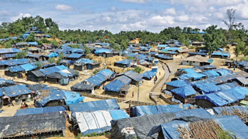
While passing over the coast of Chittagong and Cox’s Bazar districts, the coastal areas of these two districts are likely to be inundated by a high tide of 15 feet. There is a strong possibility that the eye or center of the cyclone will pass over Saint Marty Island, Teknaf, Qutubdia, and Maheshkhali upazilas of Cox’s Bazar district. There is a high risk of landslides in Rohingya refugee camps.